Why local authorities need flow data, not just water levels
Water is shifting from a resource to a managed asset. Population growth, climate pressure, and rising industrial and agricultural extraction are putting watercourses under strain – and local authorities are increasingly expected to govern, report on, and answer for the water within their districts.
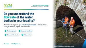
Water level height is useful information on its own. But level only tells you how high the water sits. Flow tells you the volume moving through a channel – and volume is what underpins decisions on flood risk, wastewater compliance, and resource management.
What flow data supports
Volumetric flow data feeds directly into the work local authorities already do:
- Flood management: early detection and warnings, plus the hydrodynamic modelling used to run flood-control scenarios.
- Wastewater compliance: monitoring discharge at treatment plants to demonstrate environmental regulations are being met.
- Environmental protection: tracking water availability and movement to support ecological studies and water-body protections.
- Drinking water control: managing distribution and chemical dosing across supply systems.
- Public reporting: presenting water quality, flood risk, and resource management clearly to the municipal district.
How flow is actually measured
Here’s the practical complication: most devices measure flow at a single point in time. Measuring continuous flow in a river usually isn’t practical.
Instead, monitoring relies on the relationship between water level height (stage) and volumetric flow (discharge) at each hydrometric station. That relationship is called a rating curve, and building a reliable one takes many measurements across the full range – from low flow to flood flow – gathered over a calendar year. That timing matters: river beds and embankments change with heavy rainfall, and summer growth can alter the channel.
Measurement methods include velocity–area gauging, structures such as notches and weirs, Acoustic Doppler Current Profilers (ADCP), and fixed sensors for continuous logging in open channels or pipes.
Getting it right
A few points separate good flow data from misleading data:
- Choose a straight section of channel with uniform flow, clear of turbulence and backwater pooling.
- Survey the channel cross-section, and re-check it for erosion or sediment change.
- Profile across the width – dividing into enough subsections to compute area and average velocity accurately.
- Document vegetation, debris, and undercut banks that can distort readings.
- Pair flow logging with baseline water-quality indicators like temperature, dissolved oxygen, and conductivity.
- Cross-verify automated loggers against manual measurements, and confirm telemetry is transmitting on schedule.
Where to start
Whether you’re setting up from scratch or refining an existing station, the starting questions are the same: the river, the depth, the flow, the location, and the makeup of the water. Get those right, and the instrumentation can be specified to match.
📧 info@nvm.inview.ie | nvm.inview.ie